Requesting assistance re: Tectonic Plates Plate Boundaries, & Locating Epicenter
Name ______________________________ Locate the Epicenter
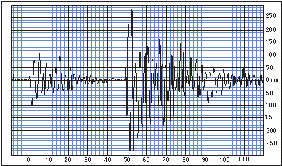
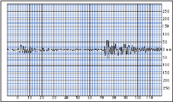
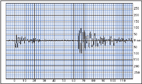
Typical seismogram of a small earthquake recorded fairly near the source. The P-waves arrive first and are later swamped by the arrival of the S-waves, The S - P interval is the time between the first arrivals of the P and S waves; it is used to determine the distance from the epicenter). This interaction produces additional seismic waves (phases) which will be detected by seismographs.
You’ll need 3 stations’ data to locate an earthquake’s epicenter. The following steps need to be taken to determine the epicenter’s location:
Determine the time difference between the P and S wave arrival.
Determine the epicenter’s distance from the station by using the P/S wave graph.
Triangulate the epicenter’s exact location using the map/compass method.
Locate the Epicenter
Measure the S-P interval from the 3 seismograms given on the last page (you may tear it off), and enter the results in the table below. Use the S-P travel time curve (2nd to last page) to determine the distance between the station and the epicenter and enter the data into table 1.
Table 1
| Station | S-P (sec) | Distance (Km) |
| Elko | ||
| Eureka | ||
| Las Vegas |
Take a compass and set its radius to the epicenter distance for each station and draw arcs around each station (map is on next page). Ideally, the three arcs should intersect at a single point, which is the epicenter; if they do not, you should go back and check your work. Clearly mark the location of the epicenter.
Is there a known fault in the vicinity of the epicenter that is likely to have slipped to create the earthquake? If so, name the fault.
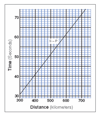
P waves travel between 6 and 13 km/sec. S waves are slower and travel between 3.5 and 7.5 km/sec. In most regions, study of numerous earthquakes with well-known epicenter locations results in an empirical S-P curve, such as the one shown above.
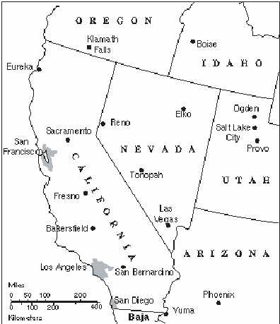
 Eureka, Ca
 Elko, NV
 Las Vegas, NV


