Answered You can hire a professional tutor to get the answer.
QUESTION
We were given a map (Meterology lab) showing the US at thee upper air map for 300 mb level.
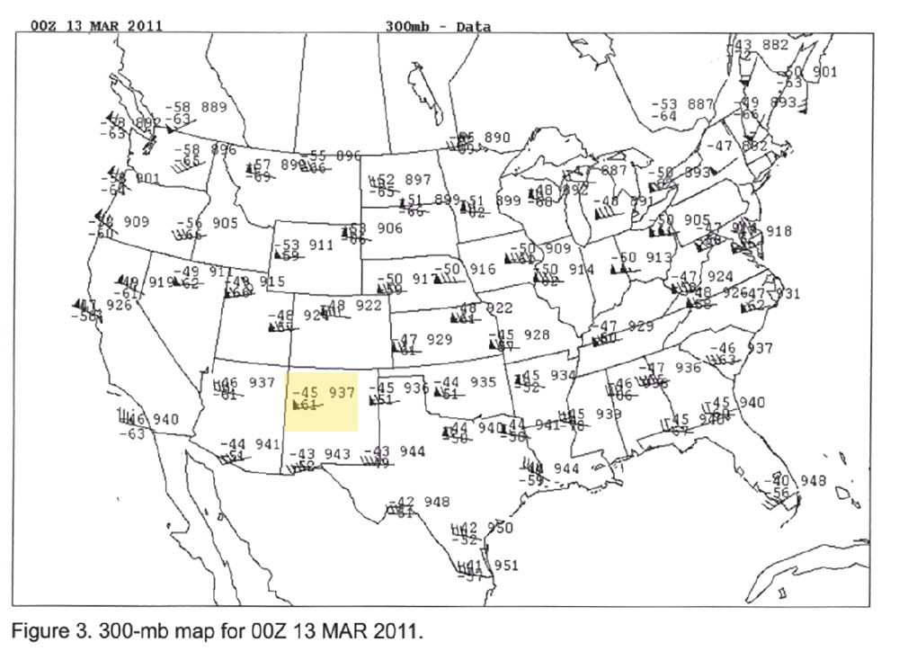
We were given a map (Meterology lab) showing the US at thee upper air map for 300 mb level. The instructions are Using a pencil, lightly shade stations that have wind speed of 50 knots or hight (triangular pennant) across the US. Then lightly shade the area between such adjoining stations to form a broad band where wind speeds are 50 knots or higher. Draw a dark, heavy, smooth, curved arrow across the map through the middle of the broad band. Add an arrowhead to represent wind direction. The la
Files:
windmapMar13.jpg
